

Features Blue Ventures: GEM
In order to comply with Google Earth Engine usage requirements, this app can only be used for non-profit purposes.
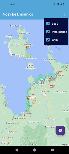
You may be asked to contact us to verify your status.The GEM allows users to view maps that highlight the location of mangroves within a certain region of interest (ROI) at two periods in time, and then compare the change in those forests between the two time periods.
Maps of mangrove imagery are classified and maps of gain, loss and persistence are displayed.
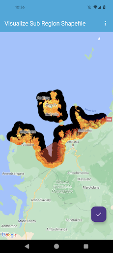
The classification of imagery requires users to provide a shapefile of classified polygons within an ROI that can be used to train the classification algorithm.
The format of this file is described in the app.The GEM app is a new version of an existing project:https://github.com/Blue-Ventures-Conservation/GEEMMMThank you for using the app!
Gaming Features
Enjoy immersive gaming experience with various game modes.
See the Blue Ventures: GEM in Action
Get the App Today
Available for Android 8.0 and above